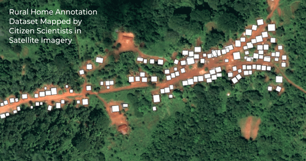
“This article presents a geolocated dataset of rural home annotations on very high resolution satellite imagery from Uganda, Kenya, and Sierra Leone. This dataset was produced through a citizen science project called “Power to the People”, which mapped rural homes for electrical infrastructure planning and computer-vision-based mapping. Additional details on this work are presented in “Power to the People: Applying citizen science to home-level mapping for rural energy access”. 578,010 home annotations were made on approximately 1,267 km2 of imagery over 179 days by over 6,000 volunteers. The bounding-box annotations produced in this work have been anonymized and georeferenced. These raw annotations were found to have a precision of 49% and recall of 93% compared to a researcher-generated set of gold standard annotations. Data on roof colour and shape were also collected and are provided. Metadata about the sensors used to capture the original images and the annotation process are also attached to data records. While this dataset was collected for electrical infrastructure planning research, it can be useful in diverse sectors, including humanitarian assistance and public health.”
Using citizen science, courtesy of the Zooniverse platform, more than half a million rural home locations were marked on high-resolution satellite imagery from Uganda, Kenya, and Sierra Leone. Data is also collected on roof colour and shape.
Read more about the data here.
This can aid with future electrical infrastructure planning in rural areas and presents a way to plug a gap in current datasets regarding rural homes. This work is part of a larger article written by members of the Department of Engineering Science, University of Oxford and funded by #CCG.
The full article can be read here:
Author Credits:
Alycia Leonard, Scot Wheeler, and Malcolm McCulloch (Department of Engineering Science, University of Oxford).
This material has been produced in part under the Climate Compatible Growth programme
Leonard, A., Wheeler, S., and McCulloch, M. (2022) Rural Home Annotation Dataset Mapped by Citizen Scientists in Satellite Imagery. Data in Brief, Vol 42, June 2022, 108262.